GRADUATION CEREMONY
by Admin User -
Moodle is an open-source Learning Management System (LMS) that provides educators with the tools and features to create and manage online courses. It allows educators to organize course materials, create quizzes and assignments, host discussion forums, and track student progress. Moodle is highly flexible and can be customized to meet the specific needs of different institutions and learning environments.
Moodle supports both synchronous and asynchronous learning environments, enabling educators to host live webinars, video conferences, and chat sessions, as well as providing a variety of tools that support self-paced learning, including videos, interactive quizzes, and discussion forums. The platform also integrates with other tools and systems, such as Google Apps and plagiarism detection software, to provide a seamless learning experience.
Moodle is widely used in educational institutions, including universities, K-12 schools, and corporate training programs. It is well-suited to online and blended learning environments and distance education programs. Additionally, Moodle's accessibility features make it a popular choice for learners with disabilities, ensuring that courses are inclusive and accessible to all learners.
The Moodle community is an active group of users, developers, and educators who contribute to the platform's development and improvement. The community provides support, resources, and documentation for users, as well as a forum for sharing ideas and best practices. Moodle releases regular updates and improvements, ensuring that the platform remains up-to-date with the latest technologies and best practices.
Links of interest:
Course Overview
This unit introduces learners to the principles and practices of planning, designing, and maintaining transport infrastructure. By the end, learners will understand how roads, walkways, and drainage systems are developed to move people and goods safely, efficiently, and sustainably.
What Learners Are Anticipated to Learn*
1. *Role of Transport Engineering* - Understand how transport networks support economic growth, access to services, and rural-urban linkages.
2. *Types of Transport Systems* - Identify road classifications, from rural access roads to highways, and basics of rail, air, and non-motorized transport.
3. *Traffic Studies* - Learn to conduct simple traffic counts, axle load surveys, and speed studies to determine road usage and capacity needs.
4. *Geometric Design Basics* - Explore road alignment, cross-section elements, sight distance, curves, gradients, and junction layouts for safety and comfort.
5. *Pavement Materials & Layers* - Study subgrade soils, sub-base, base, and surfacing options like gravel, bitumen, and concrete, plus basic material testing.
6. *Drainage & Structures* - Understand culverts, side drains, bridges, and erosion control measures to protect roads from water damage.
7. *Construction & Maintenance* - Learn stages of road construction, plant used, and routine vs periodic maintenance methods like pothole patching and grading.
8. *Safety & Environment* - Apply road safety principles, signage, traffic calming, and environmental safeguards during design and works.
*What Learners Need to Know by End of Course*
By completion, learners should be able to:
1. *Explain transport functions* - Relate road types to their purpose and traffic volume.
2. *Collect traffic data* - Carry out and record basic traffic surveys, then interpret results for design decisions.
3. *Read road plans* - Identify key geometric features, drainage elements, and pavement layers from drawings.
4. *Select materials* - Recommend suitable pavement and drainage materials based on soil type, traffic, and climate.
5. *Identify defects* - Recognize common road failures like rutting, cracking, and erosion, and suggest maintenance actions.
6. *Observe standards* - Apply KeNHA/KeRRA guidelines, safety rules, and environmental practices in all tasks.
7. *Work in teams* - Collaborate on site to set out works, measure quantities, and report progress clearly.
*Outcome*
Learners will finish the unit able to support technicians and engineers in surveying, constructing, and maintaining transport projects, ensuring roads are safe, durable, and fit for community needs.
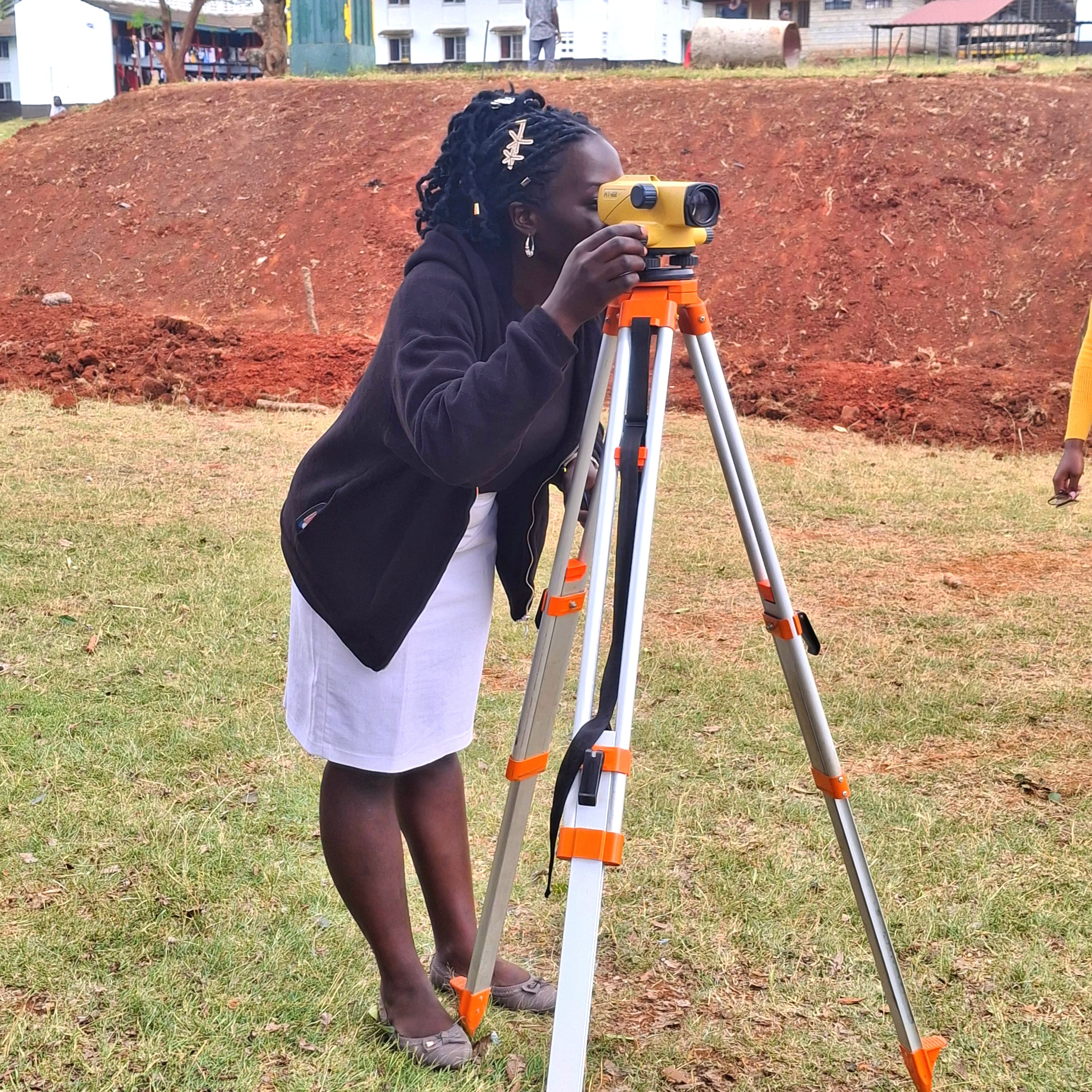
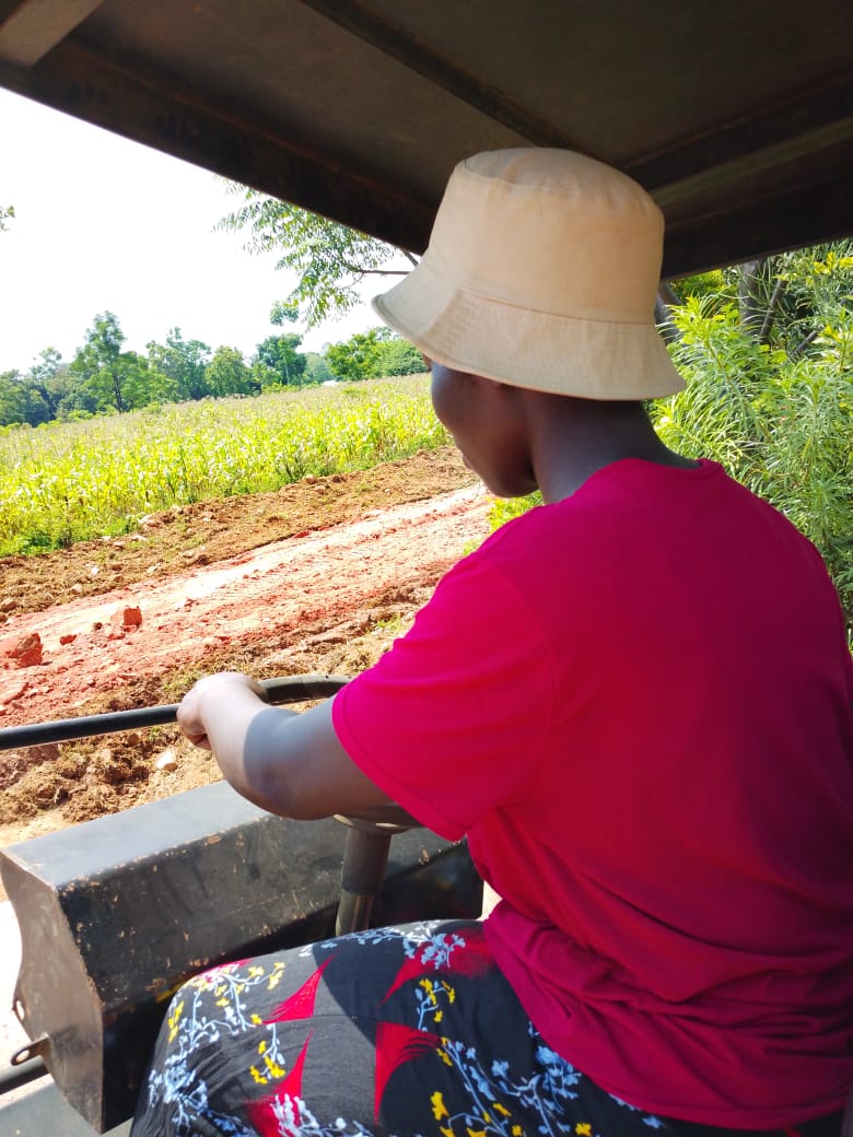
This unit equips learners with practical skills to conduct accurate site surveys for construction and civil engineering projects. By the end, learners will be able to collect, record, and interpret site data needed to guide design, costing, and safe execution of works.
1. Purpose of Site Survey - Understand why surveys are done: establish boundaries, levels, existing features, soil conditions, and utilities before design starts.
2. Survey Equipment Use- Identify and operate tools such as tape measures, dumpy levels, total stations, GPS, ranging rods, and pegs. Learn setup, calibration, and care.
3. Field Procedures - Carry out reconnaissance, establish control points, take linear and angular measurements, record level data, and mark points on site.
4. Data Recording & Sketching - Keep accurate field notes, booking sheets, and prepare preliminary site sketches showing key features, slopes, and access.
5. *Health & Safety - Apply safety rules when working near roads, excavations, and live services. Use PPE and follow risk assessment protocols.
6. *Interpretation & Reporting* - Transfer field data into simple plans, sections, and reports that engineers, architects, and foremen can use.
*What Learners Need to Know by End of Course*
By completion, learners should be able to:
1. *Plan a survey* - Select suitable methods and equipment for a given site and task.
2. *Execute fieldwork accurately* - Measure distances, angles, and levels within allowable tolerances, avoiding common errors like parallax or misbooking.
3. *Identify site constraints* - Spot existing structures, trees, waterways, power lines, and poor soils that affect design.
4. *Produce usable outputs* - Compile clear field notes, reduce level data, and draft a scaled site plan with legend, north point, and spot heights.
5. *Communicate findings* - Write a concise site survey report stating recommendations, hazards, and next steps for the project team.
6. *Uphold professional standards* - Demonstrate teamwork, accuracy, honesty in data, and adherence to safety and environmental guidelines.
*Outcome*
Learners will leave the unit ready to support technicians and engineers in real projects, ensuring that construction starts on reliable, well-documented site information.